
Thomas Van de Velde · October 12, 2026 · Gorham (2G8)
The forecast for Monday said the day would start weak and get stronger, and that cloud and gusts would shut it down before it was through. It did all three. I launched at 12:12 into air that was barely moving, and by the time the wave was getting serious, the camp was being recalled.
I got 84 minutes out of it, and for most of the first hour I was below four thousand feet, working for every foot of the way up. That turned out to be the interesting part. From Gorham there are three ways into the Mount Washington wave, and Monday's flight managed to visit all of them.
1 · The direct tow
The simplest way up is the one you pay for. The tow runs down the valley toward the mountain and delivers you into the wave — often lower than you would guess; wave can be found well below the summit — and the most reliable window anywhere on the mountain is near The Horn, the northern shoulder just above the Great Gulf.
That is the appeal: minutes after the rope comes tight you can be in smooth air with thousands of feet of climb ahead of you. The catch is everything around it. Tows into the wave are long, and every long tow is several launches the field doesn't get. The ride out passes through the rotor, which can be the roughest air of the day — the passenger on the rope gets the rodeo. And a glider that arrives this way has no picture of the lower air at all. You know where the wave is; you don't know what the valley is doing. If the wave lets go, you are suddenly flying a plan you never made.
2 · The high road, over the Carters
The second way is to get high first. A short tow — three thousand feet can be enough — puts you on the Moriah–Carter ridge southeast of the field. From there the ridge is a ladder: work it south, climb in whatever ridge lift and scraps of rotor and thermal you find, and at your best height punch out west for the lee side of the Presidential range, aiming for the wave line you think is working.
This is the route the club's pilot brief describes as the usual one, and it has an honest logic: you cross the valley with height in hand, and you keep the ridge behind you as an escape. It also has a bill. The ridge you are climbing can be starved by the very wave you are chasing — when the wave's sink sits down on it, the lift that was supposed to carry you south simply is not there. Every mile south is a mile further from the field, over country with nowhere to land. And the punch-out happens at the altitude you have earned, not the one you wanted.
3 · The low road, climbing in rotor
The third way works from underneath. Below the wave, on the lee side of the mountains, the air curls back on itself: the rotor. It is not smooth lift. It is broken, punchy and local, marked by shredded cloud, with sink waiting on every side — but on a day when the wave is late, or a tow hasn't connected, it is the way up that is left.
You climb it the way you climb anything you don't entirely trust: in small bites, staying close to a retreat, moving downwind as you gain height until the air smooths into wave — and then, if you are positioned right, pushing upwind into the primary. That last move costs altitude and is easy to get wrong. It is also the move that turns a sinking day into a save.
Monday's flight
Monday ran the whole list, in order. I launched at 12:12; the first tow was the direct kind, out toward the primary; and it went nowhere.
Loading the terrain and the track…
The whole flight in 3D — drag to orbit, scroll to zoom, and the buttons walk the stages. Amber is the low work on the Moriah–Carter ridge; cyan, the crossing below the rotor; green, the climb; and violet, the push upwind into the primary. The barogram along the bottom is a scrubber — play the flight, or drag to any minute; the grey mass under the line is the terrain directly beneath the track.
The tow released me at 4,300 feet into air that wasn't working yet. I spent the next ten minutes hoping it would change — a couple of probes on the lee side, one fast run east looking for a window — before conceding. By 12:27 I was down to 2,300 feet and pointing at the only thing that was working at all: the Moriah–Carter ridge.
The next half hour was the real work of the day. The ridge's northwest-facing flank was giving just enough — true ridge lift, plus the odd scrap of rotor — to hold and slowly gain. I worked it in the low two thousands, crossing the slope between Imp Face and Mount Surprise, never far off the rocks. At 12:35 came the low point of the flight: 1,857 feet. Thin air, on a flank with no landing options anywhere below it. That is the kind of moment that decides whether a flight becomes a story or an incident.
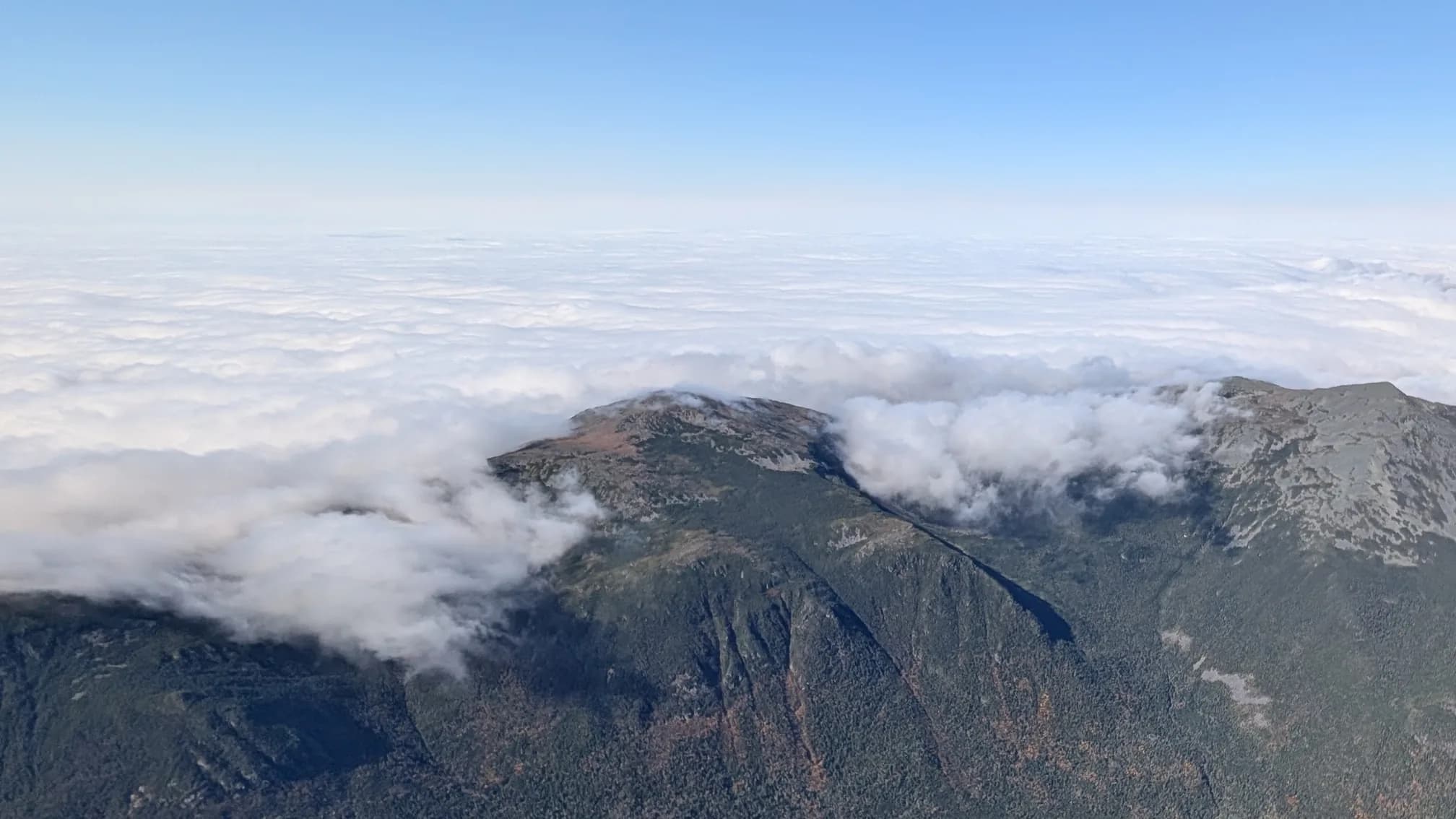
Then the day began to change, as forecast. By 12:55 the ridge had carried me up to 3,900 feet, and I made the second decision: leave the ridge and cross the valley west, under the rotor, for the lee of the Presidential range. The crossing cost about 700 feet and bottomed at 3,200 — low, but under the right sky.
What followed was the third method, working exactly as it is drawn up. From 12:58 I climbed, first in the rotor's churned air over the valley, until the lift smoothed and steepened into real wave — the kind you can circle in like a thermal. In twenty-two minutes I went from 3,400 to 7,600 feet; the best five minutes of it, shortly after one o'clock, averaged 350 feet a minute.
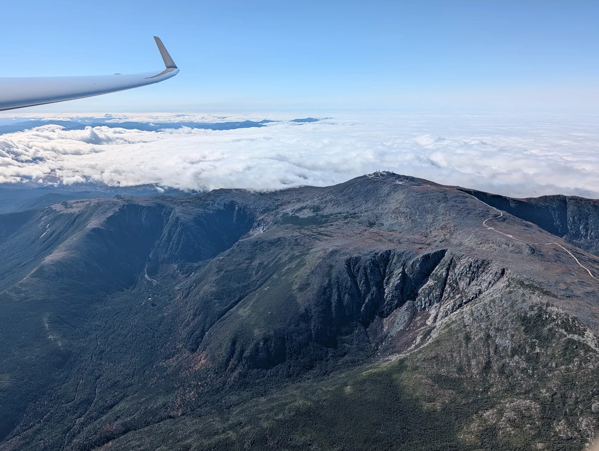
The last move was the upwind one. I pushed northwest into the strongest part of the primary, over the rim of the Great Gulf near The Horn, and topped out at 7,943 feet at 13:24. The summit cone slid by below the left wing — as the photograph at the top of this piece shows — with the undercast lying over everything north of the mountain.
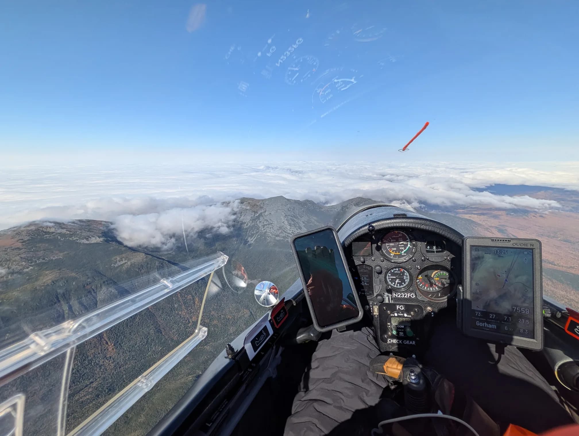
Below me, the camp was already shutting down. The ceiling was lowering, the gusts were up, and the tow pilots had called the recall while the wave was only beginning to cook. I gave the mountain one more look, turned downwind, and rode the long descent home. Landing came at 13:36.
What the hard way is worth
The arithmetic is easy to do and easy to misread. A long tow on a day when it works would have put me in the wave in fifteen minutes; the low road took an hour and most of my margin. What it bought instead is the picture the tow never gives you: where the rotor actually sits on a northwest day, how the valley feels when the wave is late, and which parts of the ridge to trust. That is the currency the wave accepts.
All three ways work — the trick is reading which one the day is offering. Monday offered the low road, with a marginal ridge and a late wave, and then spent an hour proving it was the one that would connect. When the wave is forecast to build, it usually does. Having the patience to climb to it is most of the game.
The trace is logged at WeGlide ↗. The day also appears in Glen Kelley's camp logbook, and every camp flight since 2016 is drawn in the 3D archive.