— Reading —
Wave flying is dangerous – one of the more dangerous activities that humans voluntarily engage in. With experience and care, the risks can be lowered, but not eliminated. Some aspects of safety in wave and mountain flying are presented here, but this is far from a complete discussion, and some of this material is not aimed at beginners. Pilots should strive to develop the judgment that will keep them safe, understanding that mountains such as these can present conditions in which even excellent aircraft and skilled pilots cannot safely fly.
"The best way to get sent to the back of the launch grid is to show up not having studied the published documents."
Mount Washington Brief
Flying Mt. Washington area wave from Gorham, NH. Copyright by John F. Good.
This is a required reading for all attending the wave camp. It is recommended that you print a copy and bring it with you. Please respect John's copyright and do not reproduce this document for any purpose other than your own personal use.
Continue readingOxygen Talk
This is the talk on oxygen systems given by Steele Lipe at the 1995 SSA Convention.
Continue reading
Legal & Regulatory
Legal interpretations and regulatory information as pertinent to the Wave Camp.
Class A Airspace Waivers
Certificate of Waiver Authorization aka Letter of Authorization (LOA) issued to Mt Washington Soaring Association
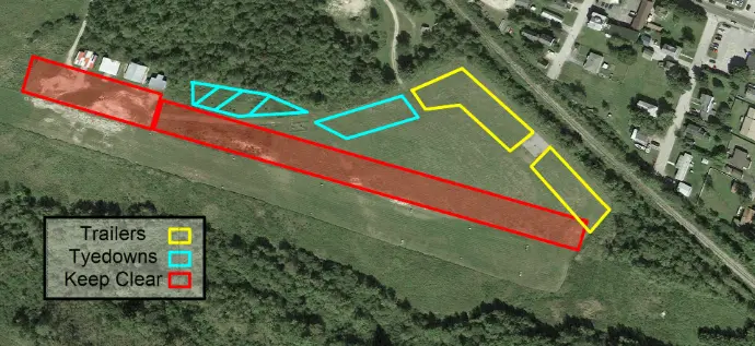
Gorham (2G8) Airport Information
Parking Map: designated trailer and tiedown locations, and areas to keep clear at all times.
Gorham (2G8) Pattern Procedures
Attention all Wave Campers: Here are our (2023) airport procedures. Print a copy. We'll brief this at our daily pilots' meetings.
Navigational References
References to local landmarks in the area: Pine Mountain, Hayes, Carter Dome, Mt Moriah, Madison, Jefferson, Washington, The Horn, Wildcat, The Great Gulf, Tuckerman's Ravine, Huntington Ravine, the Pilot Range, the Crescent Range are good things to know.
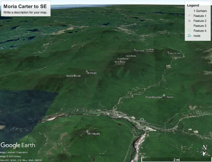
Moriah Carter to SE
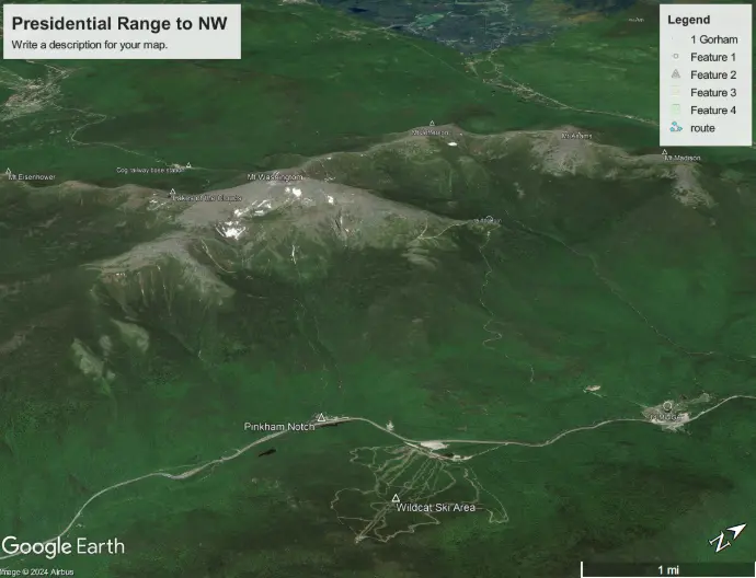
Presidential Range to NW
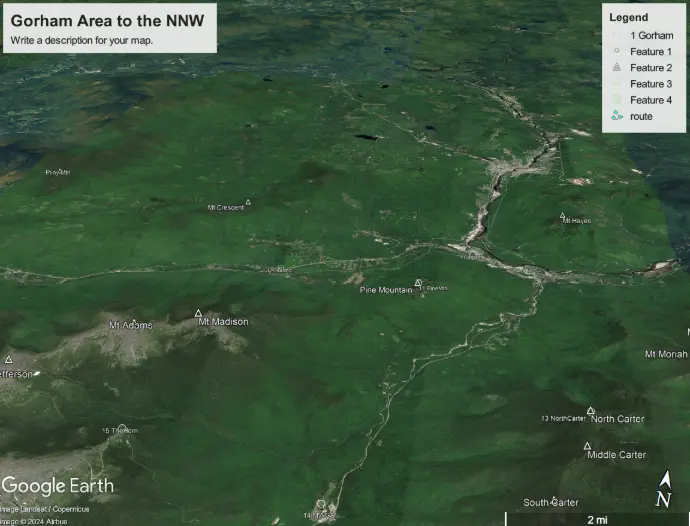
Gorham Area to the NNW
45-Minute Diamond: Mt Hays to Primary Transition Example
Download and view the file in an IGC viewer.
Additional Electronic Files
Gorham overlay file one can open in Google Earth (courtesy of John Good): GorhamNH.kmz Gorham area waypoint information Gorham13.cup: Gorham area waypoint file appropriate for the Wave Camp
soaringweb.org/TP/Gorham: Gorham, NH Waypoint Database
Airspace files (so that the 10-mile wave airspace is depicted on your moving map (courtesy of Dave Sherrill)
TopHat and XCSoar (Newport-Peace format)
mwsa.sua: text for the Glider Area only
allusa.v23.02-23.2.mwsa.sua: all USA airspace with the Glider Area
SeeYou Navigator (OpenAir format)
mwsa.txt: the Glider Area only
allusa.v23.02-23.2.mwsa.txt: all USA airspace with the Glider Area
Wave Cross-Country Glider Flights
Planning for the Mt. Washington area wave cross country glider flights
Missing file: Mt. Washington Area Wave Cross-Country Glider Flights
When flagpole sitting in wave becomes routine, this document describes some possible routes for meaningful cross country flying utilizing the wave systems in the area. The landing options on the northern routes are sparse and sometimes distant from the course line. Please note that not only the condition, but even the existence of some of the reported landing areas must be confirmed before attempting some of these routes.